Saudi Arabia relief location map.jpg
조무위키
미리 보기 크기: 720 × 600 픽셀 다른 해상도: 288 × 240 픽셀 | 577 × 480 픽셀 | 922 × 768 픽셀 | 1,230 × 1,024 픽셀 | 2,003 × 1,668 픽셀
원본 파일 (2,003 × 1,668 픽셀, 파일 크기: 1.67 MB, MIME 종류: image/jpeg)
| 설명 |
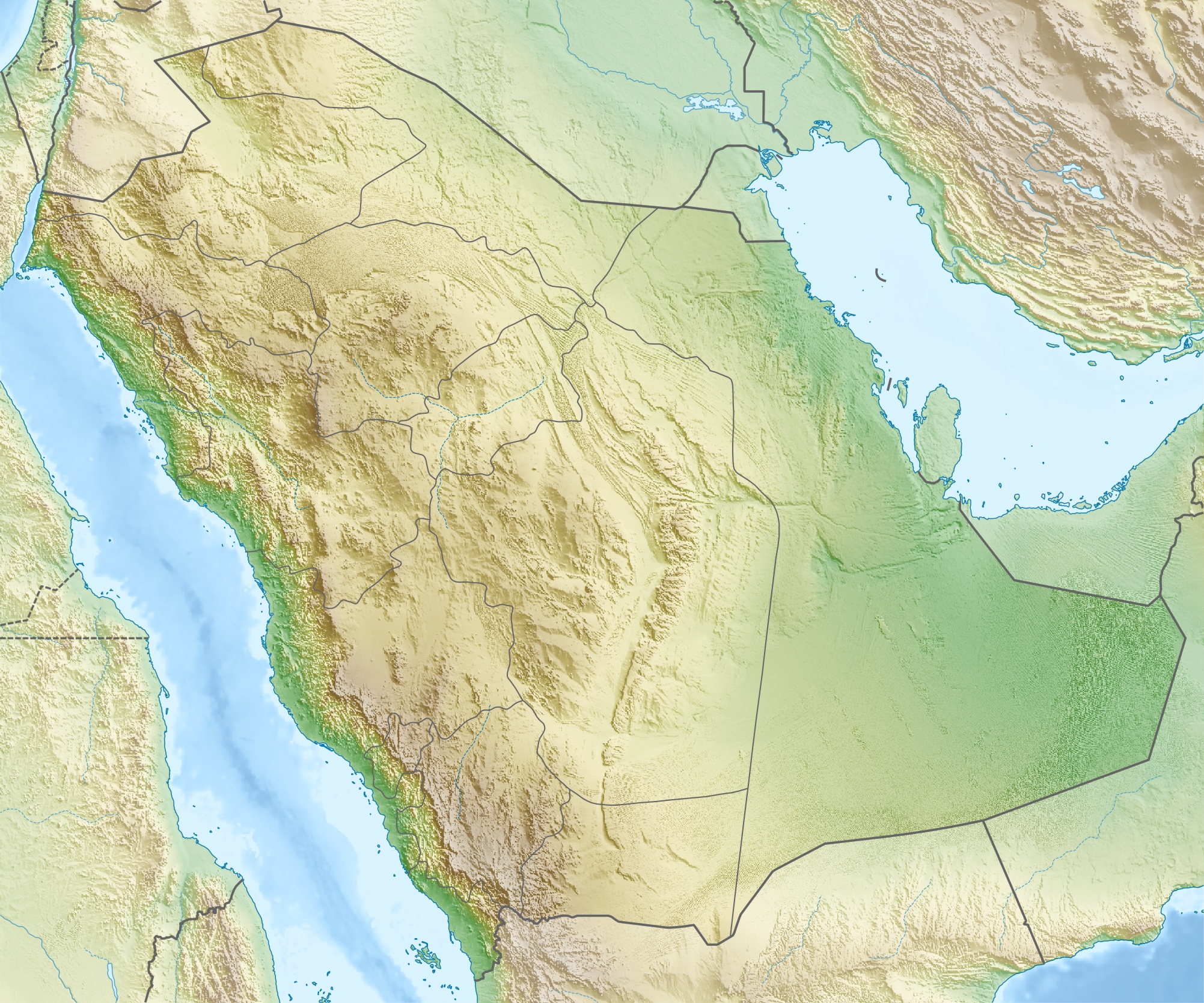
العربية: خريطة مواقع السعودية.
إسقاط متساوي المستطيلات (الإسقاط الجغرافي)، شمال / جنوب امتداد 110٪. الحدود الجغرافية للخريطة:
Deutsch: Physische Positionskarte von Saudi-Arabien
Quadratische Plattkarte, N-S-Streckung 110 %. Geographische Begrenzung der Karte:
English: Physical location map of Saudi Arabia
Equirectangular projection, N/S stretching 110 %. Geographic limits of the map:
|
| 날짜 | |
| 출처 | 자작, using map data from administrative map by NordNordWest. The relief was created from SRTM-30 relief data. |
| 저자 | Carport |
| 저작권 (이 파일을 인용하기) |
이 파일은 크리에이티브 커먼즈 저작자표시-동일조건변경허락 3.0 Unported 라이선스로 배포됩니다.
|
| 다른 버전 |
|
.jpg)


파일 역사
날짜/시간 링크를 클릭하면 해당 시간의 파일을 볼 수 있습니다.
| 날짜/시간 | 섬네일 | 크기 | 사용자 | 설명 | |
|---|---|---|---|---|---|
| 현재 | 2010년 5월 17일 (월) 02:28 | | 2,003 × 1,668 (1.67 MB) | wikimediacommons>Carport | {{Information |Description={{de|Physische Positionskarte von {{w|Saudi-Arabien|3=de}}}} Quadratische Plattkarte, N-S-Streckung 110 %. Geographische Begrenzung der Karte: * N: 32.5° N * S: 16.0° N * W: 34.2° O * O: 56.0° O {{en|Physical location map of |
이 파일을 사용하는 문서
다음 문서 1개가 이 파일을 사용하고 있습니다: